
In the beginning of March 2023, I took my best friend to the South Island of New Zealand as a celebration of 20 years of friendship. Though we flew into Auckland (on the North Island), we took the next flight to Queenstown, which is quite far south on the South Island. We then rented a car and worked our way back north from Queenstown to Christchurch, then onto Blenheim (with a stop in Kaikoura on the way), and lastly to Nelson before departing.
For a photographer who especially enjoys landscapes, I had to resist photographing every beautiful area because that’s essentially the entire country. I took thousands of photos (not an exaggeration), but the ones below were some of my favourites. I have organised them according to the area and timeline of our trip.
Feel free to click on any of the thumbnails to see larger versions (though, even the larger versions are still only 25% of the original size). If you would like to use the full-resolution image, please leave a comment and I will contact you to discuss.
Queenstown
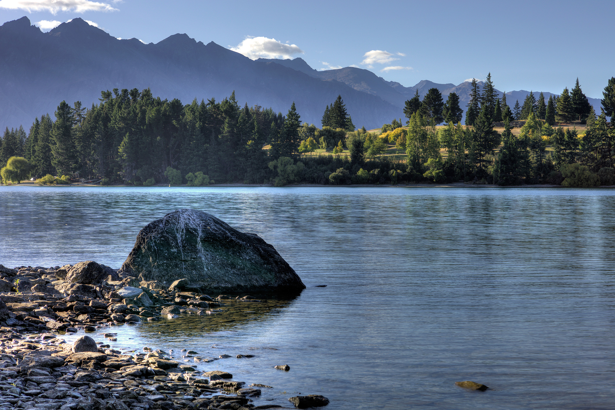
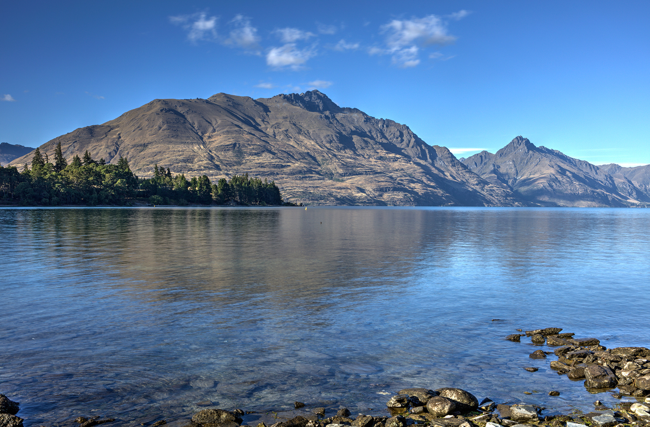
The first three photos (of Lake Wakatipu) were taken from right down the street from our hotel. Needless to say, the views were wonderful from our balcony as well.
Lake Wakatipu in Queenstown – just after sunrise
Lake Wakatipu in Queenstown – at the rocky shoreline
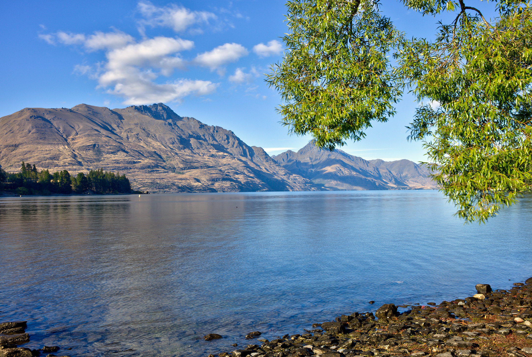
Lake Wakatipu in Queenstown – trees hanging over the shore
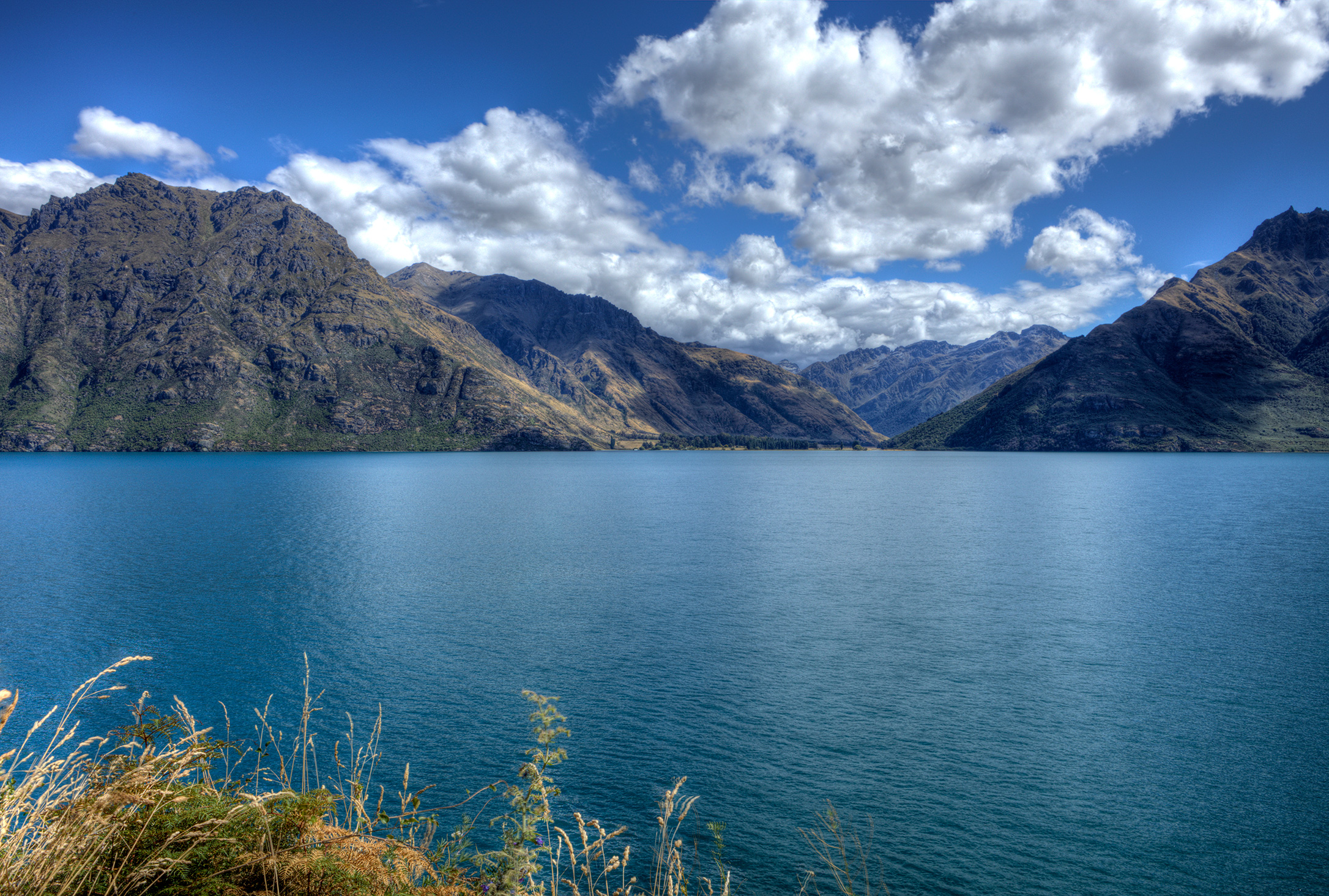
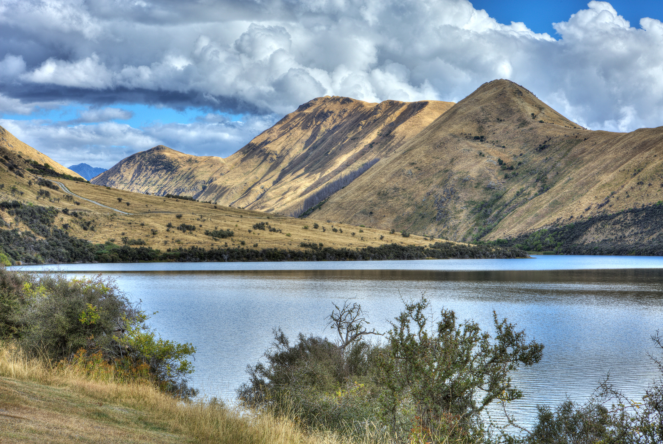
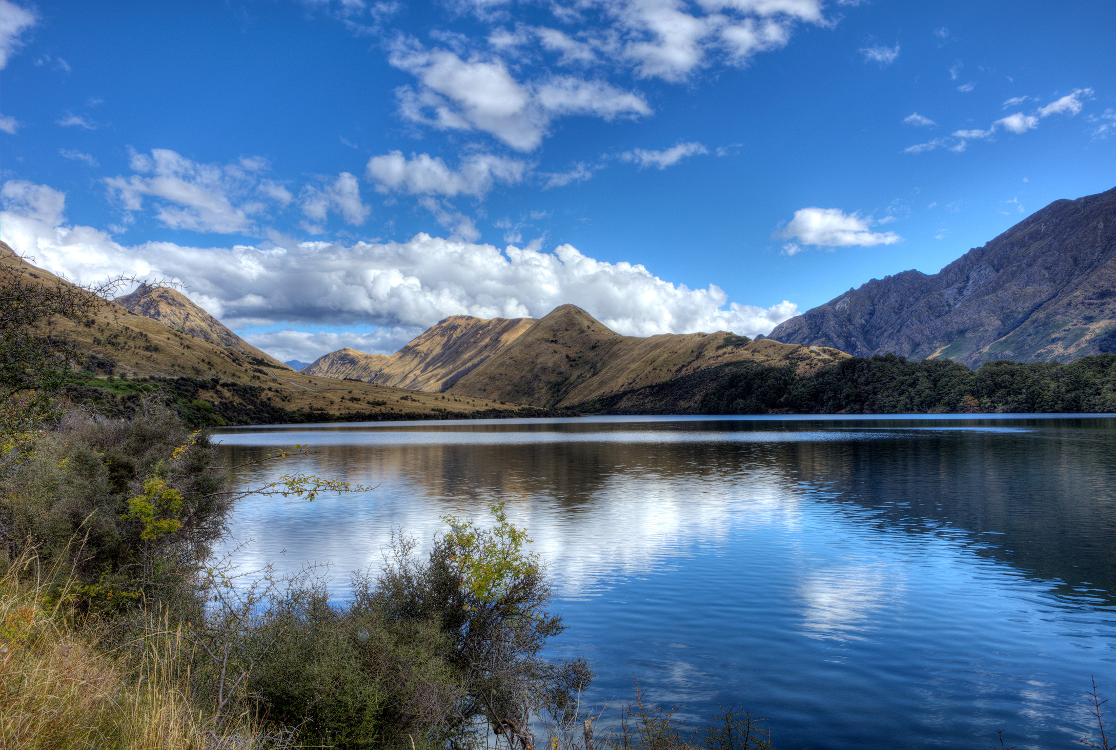
Halfway Bay in Queenstown – radiant blue-green waters

Halfway Bay in Queenstown – much more dramatic clouds
Moke Lake, which is a short drive northwest of Queenstown, ended up being my favourite place not only in the area, but on the entire trip. It was so beautifully serene and peaceful, and the hike around the lake was magnificent.
Moke Lake in Queenstown – looking back at the entryway
Moke Lake in Queenstown – broader scope of the entryway

Moke Lake in Queenstown – facing north to the mountains
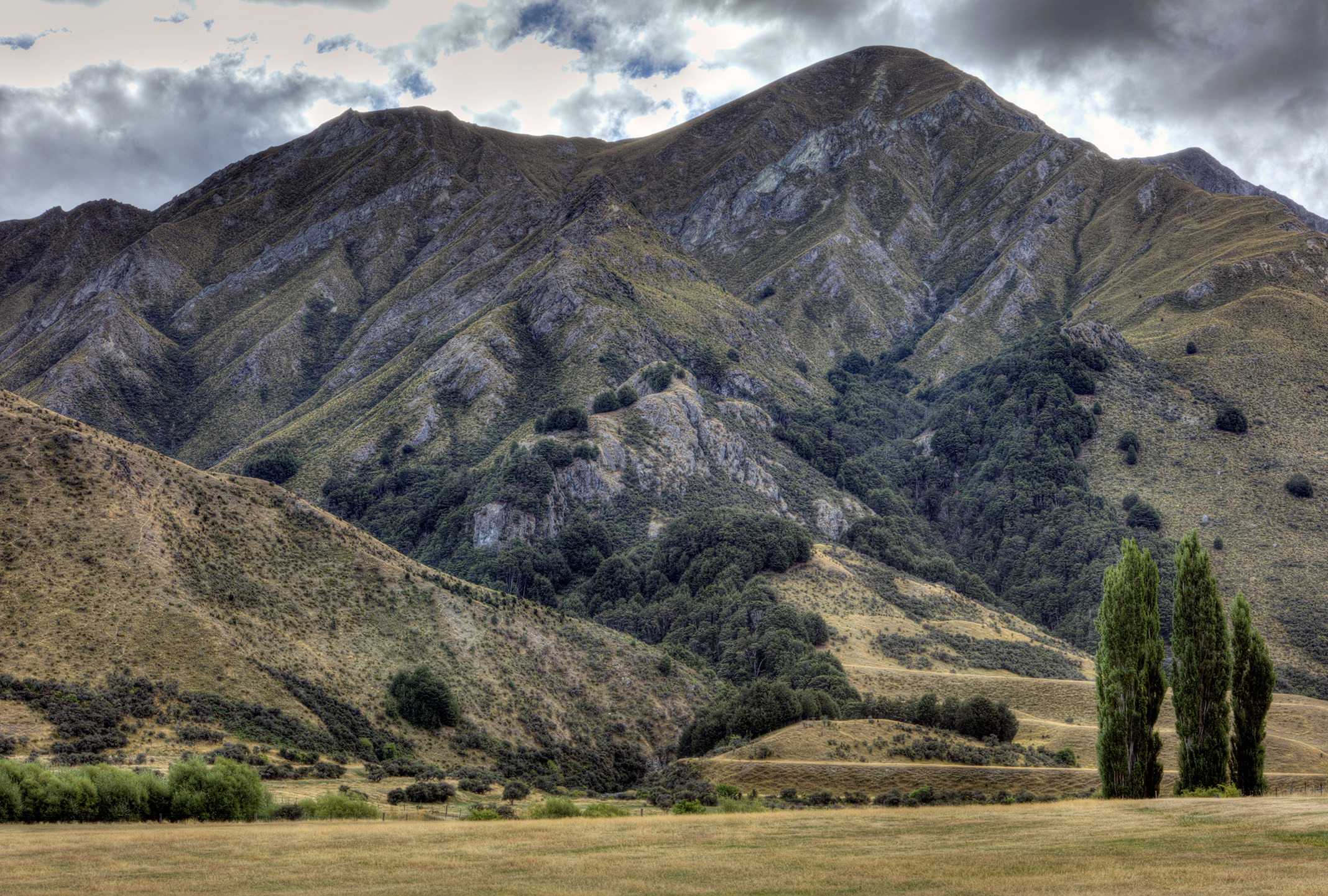
Moke Lake in Queenstown – a storm brewing
Wānaka
The town of Wānaka is about a 1-hour drive northeast of Queenstown, but it is a challenging drive as the road twists and turns through the mountains. I had to see it, though, primarily because of the infamous tree.

Wānaka Lavender Farm – a bench to take in the views
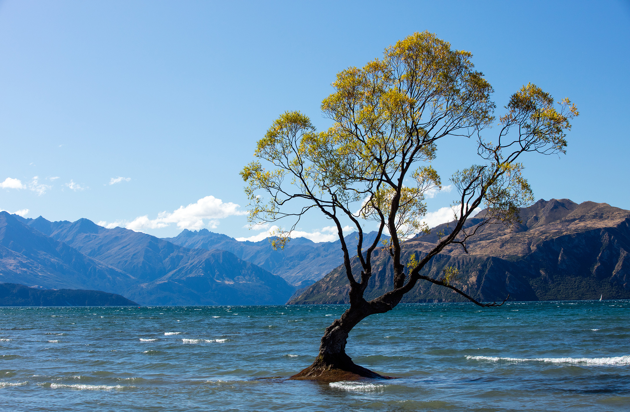
The infamous Wānaka Tree
Christchurch
The trip from Christchurch to Akaroa (where many go to dolphin watch) is lovely through and through. Approximately halfway, there is an offshoot into the Kaituna Valley. That’s where I found the beautiful St. Kentigern’s Anglican Church.
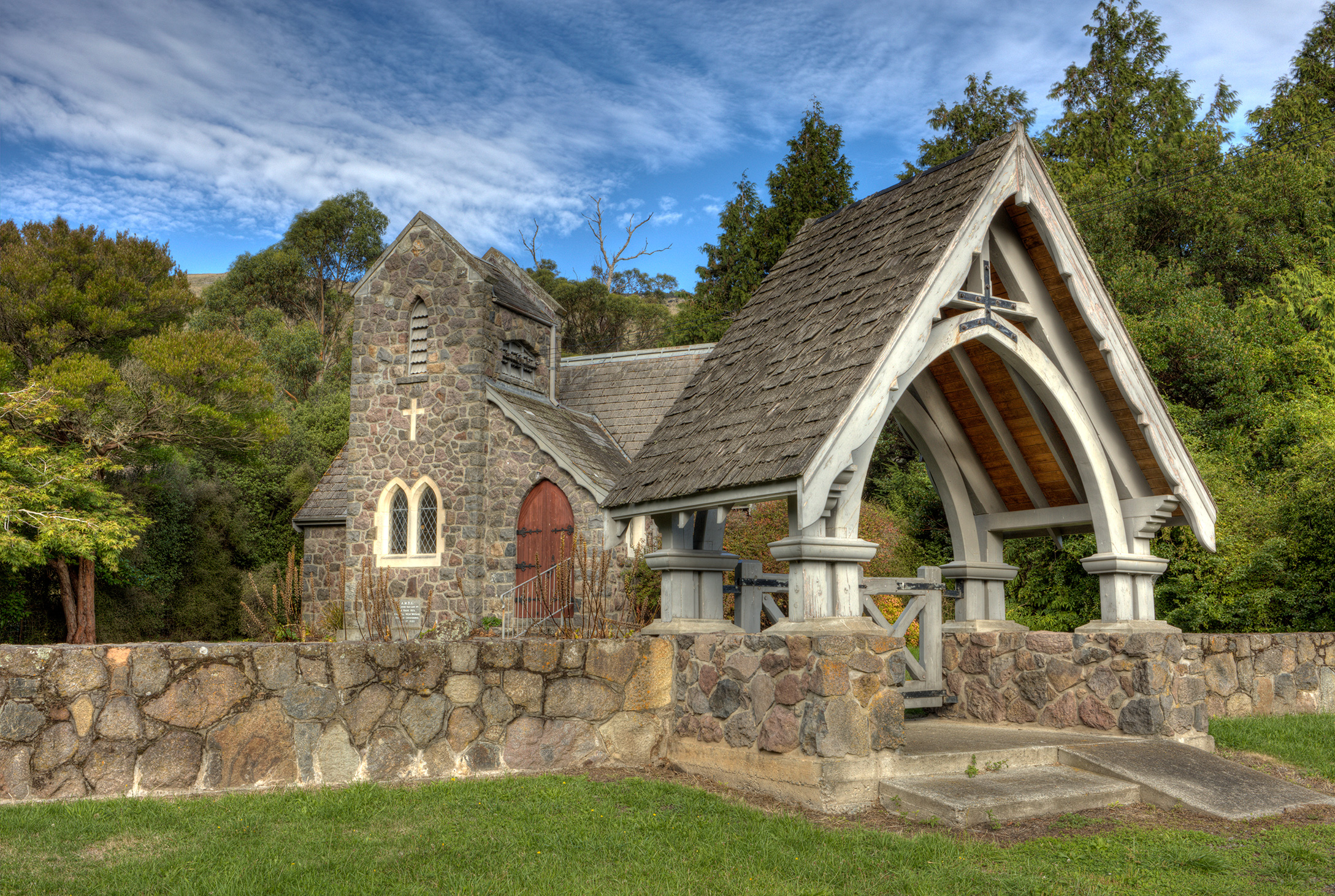
St. Kentigern’s Anglican Church in Kaituna – from the street

St. Kentigern’s Anglican Church in Kaituna – opening the gate
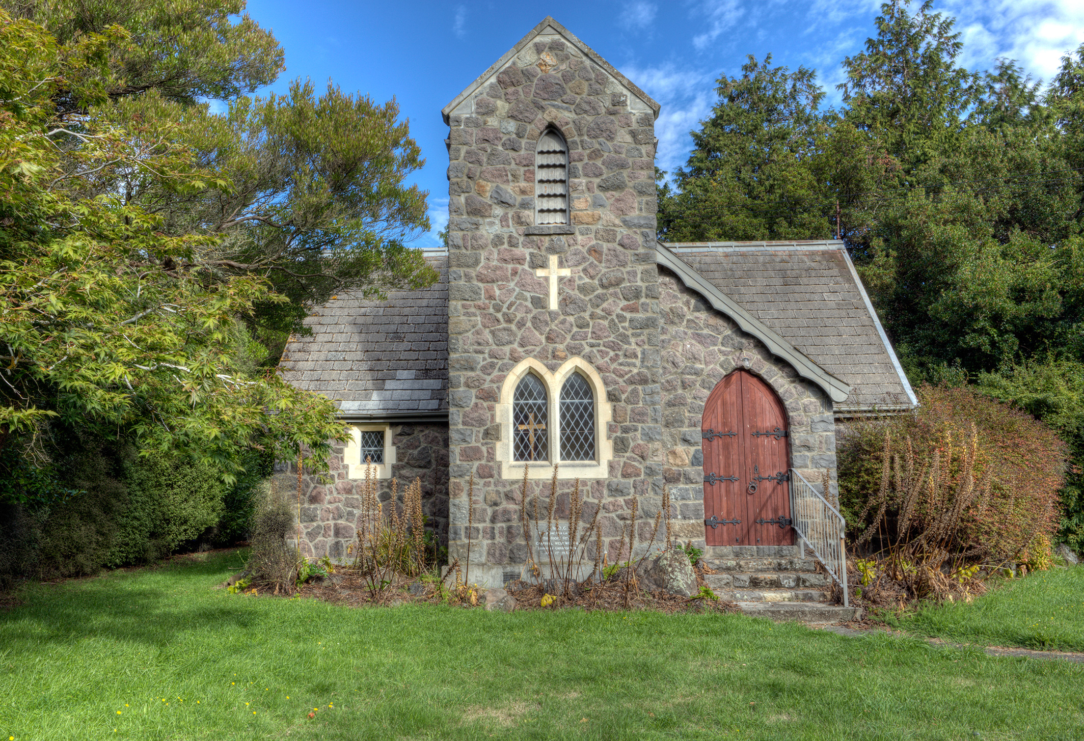
St. Kentigern’s Anglican Church in Kaituna – front view
Nelson
All around “Sunny Nelson” are beautiful beaches and pristine waters. Making the ~3-hour drive each way to see Cape Farewell—the farthest north spot on the South Island—may seem daunting (and it is in spots), but it is worth the time. I wish we could have stayed the night there so that we could have walked more of the trails.
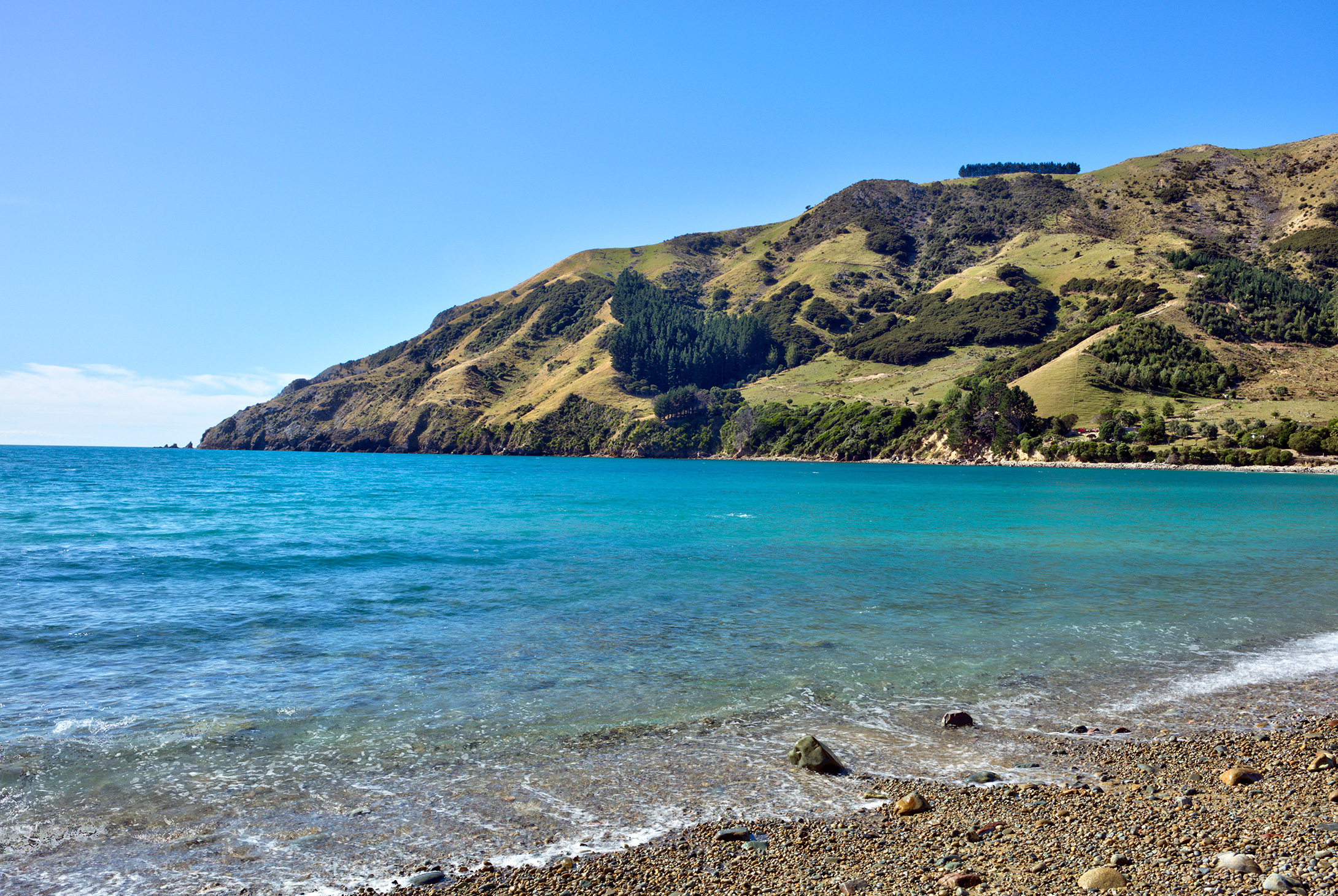
The stunning waters at Cable Bay in Nelson
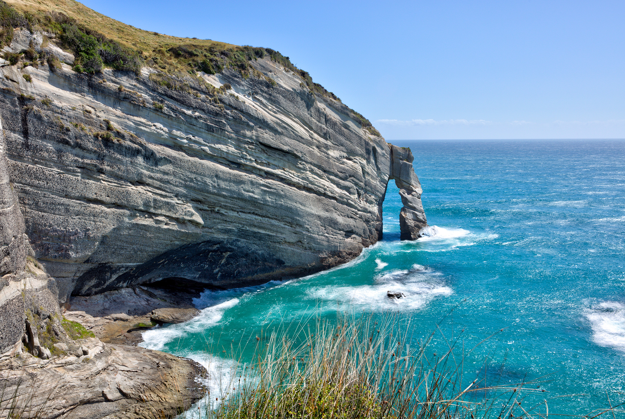
Looking north across the vast Pacific Ocean at Cape Farewell
At the edge of the world – Cape Farewell
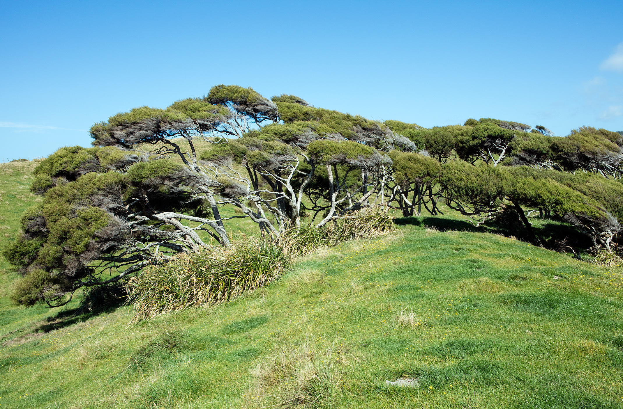
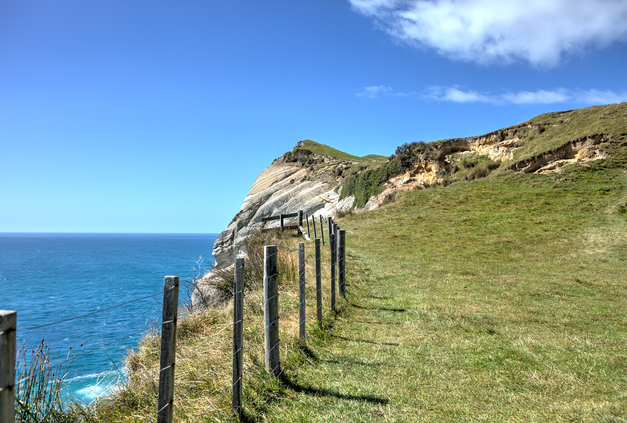
Windswept trees on the trail to Wharariki Beach
Closer to Nelson, the Riwaka Resurgence (which is the source of the Riwaka River) proved to be one of the most gorgeous areas that I saw. The waters throughout New Zealand were otherworldly colours, but this spot in particular was unlike anything I’ve ever seen.
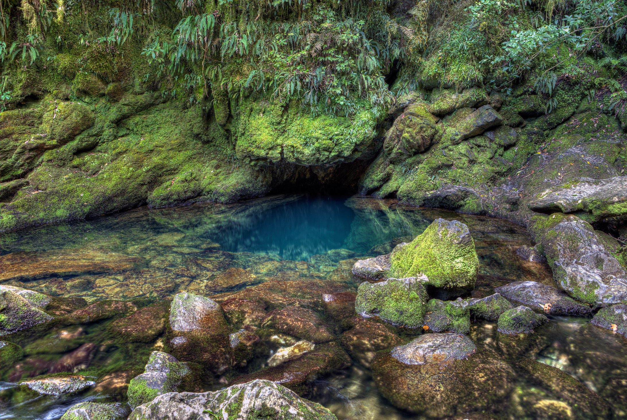
The underground source of the Riwaka River (The Riwaka Resurgence)
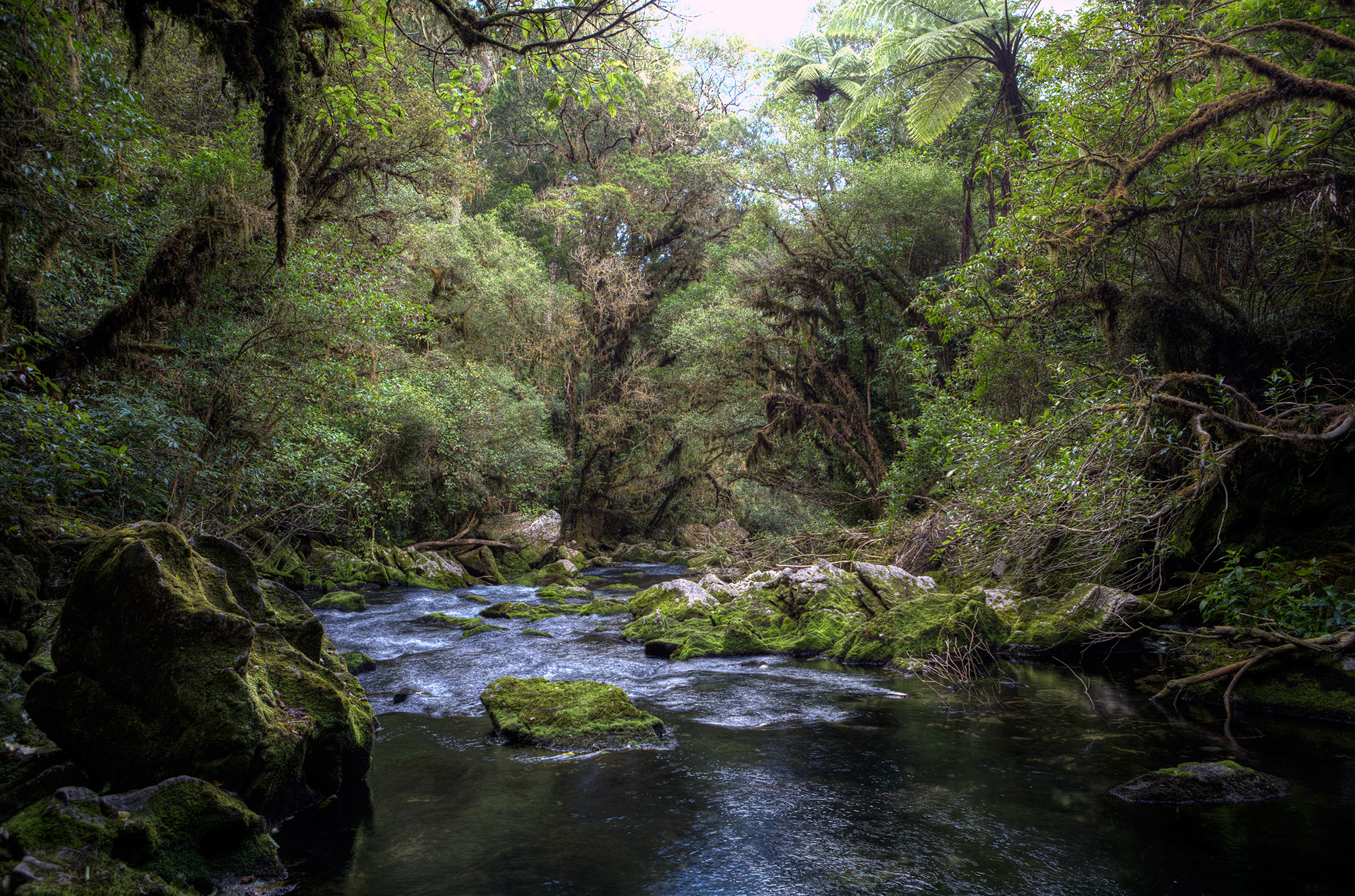
The Riwaka River flowing from its source
Though there were tons of other beautiful spots throughout the trip, these were taken with my digital SLR and were the shots for which I took a substantial amount of time setting up (e.g. positioning a tripod, taking light meter readings, multiple exposures, et cetera). At some point, I may go through the photos that I took with my mobile and post some of them as well.
Cheers,
Nathan Zachary

2 comments
Hey, I just thought I’d let you know that it seems like your em dashes in the sentence “Making the ~3-hour drive each way to see Cape Farewell—the farthest north spot on the South Island—may seem daunting…” got HTML escaped. However, the photos you’ve taken looks amazing. 🙂
Author
Thank you for letting me know, Miroslav! I have updated the post to fix the problem with the em dashes. I also appreciate your kind words about the photos. 🙂
Cheers,
Zach